On Sunday, Sept 6, Matt and I hiked the Highline Trail of Glacier National Park to spend two nights at the Granite Park Chalet. We hit the trail at 2:30 on a cold, windy and rainy afternoon. It was not an auspicious start to the journey. We were definitely glad that we had decided not to force our eight year old son to go after seeing a forecast for 3 days of inclement weather (rain, snow and 20mph winds forecast). While it would have been doable, it might have put him off hiking for life.
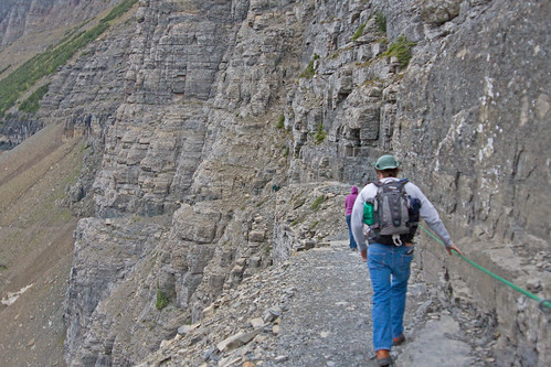
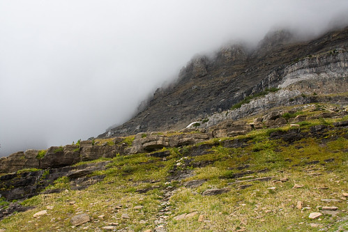
The Highline Trail begins across Going to the Sun Road from the parking lot for the Logan Pass Visitor Center. At the very beginning the trail goes gently downhill, allowing hikers to get “warmed up” and enjoy the view. After a few hundred yards the trail gets more rugged as it is a ledge on the cliff of the Garden Wall. Along this stretch the Park Service has bolted a cable to the cliff wall encased in garden hose to provide a hand rail of sorts.
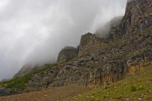
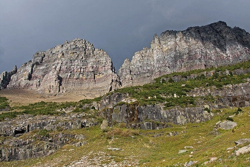
After this section of trail, the landscape opens up a bit, though we couldn’t see a whole lot of it on this day due to passing storm clouds.
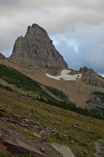
In fact, from reading other descriptions of this trail, I believe that Haystack Butte is usually visible to the hiker at this point. It did not become visible to us for some time. Haystack Butte is a handy landmark for a hiker. As one passes “behind” it, one reaches the 3.4 mile mark of this 7.6 mile hike. If one has no means by which to gauge distance traveled (as we did not), the mileage of landmarks is a way by which to measure progress.
By the time we had traveled perhaps a mile and a half, I told Matt I needed to stop and check 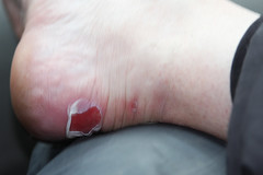 on my heels and see if I could get a bandaid on to prevent blisters from getting worse (didn’t have any moleskin – a mistake I won’t make again). Upon removing my boots, I found that it was too late for blister prevention. I already had open blisters that seemed to be, at that moment, about as big as Butte’s Berkely Pit. Well, I guess it’s time to replace my 5 years old and beyond worn out hiking boots… Hindsight 20/20. In the mean time, I had about 10 miles left to go of this trip — 6 on this day and 4 more on Tuesday. Matt did offer that we could bag it, but we had both been so looking forward to this trip for months. Mind over matter… On we went.
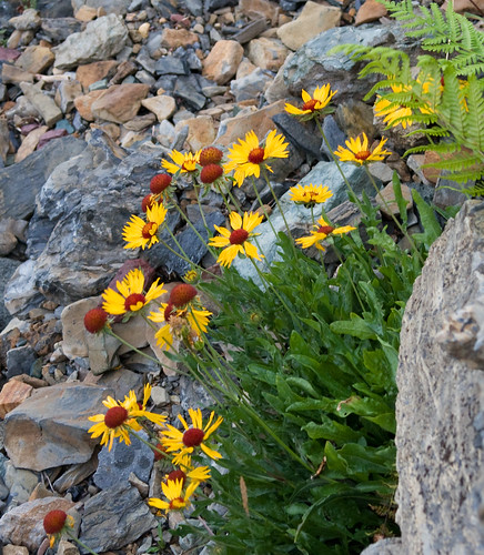
We’ve enjoyed a rather wet summer. The huckleberry crop this year is fantastic. Other wildflowers, often dried up by this time of the year, were still abundant. Among them were gallardia (pictured below), sulfur buckwheat, showy fleabane, heartleaf arnica, even a few paintbrush. The ferns to be found in Glacier National Park testify to the fact that this region receives far more precipitation than neighboring country.
 Speaking of huckleberries, we also definitively observed the answer to the age-old question: a bear shits in the woods ONLY if a trail is not available. “What does that have to do with huckeleberries?” you might ask if you are among the “uninitiated.” Well… during huck season bear scat is purple huckleberry splatter (containing seemingly whole berries). It’s a rare stretch of trail that isn’t so “decorated.”
As we slowly approached Haystack Butte we could see white dots up on the mountains that the use of binoculars confirmed to be mountain goats. At about 2 miles we encountered our first close wildlife of the trip — a bachelor group of bighorn rams right on the trail. The group was comprised of mature rams, a couple with broomed horns, some “middle-agers” and also some youngsters. By the time we had reached them they had moved about 25-30 yards off the trail. 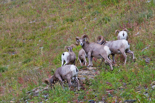
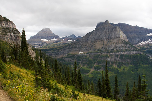
As we continued on across the open park before Haystack Butte, I enjoyed looking back to see Mount Oberlin and Mount Cannon becoming more distant with each step of progress I took on my painful blisters.
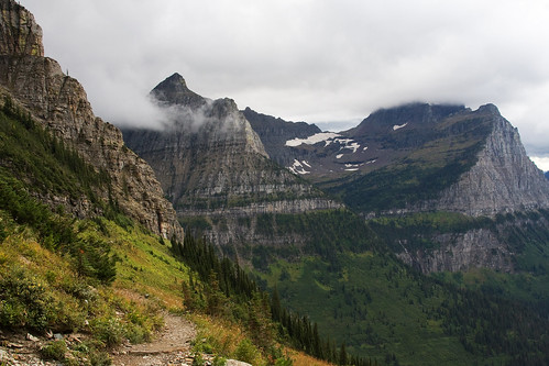
Mount Reynolds, similarly, began to dwindle in the distance.
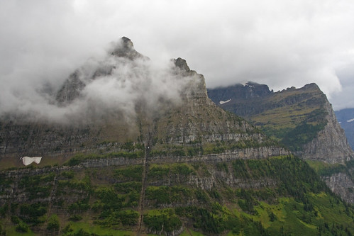
Low flying wind whipped clouds continued to obscure the mountain tops and brought to mind the dwarves’ song from The Hobbit, “far over the Misty Mountains cold…”
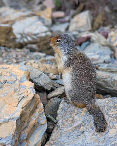
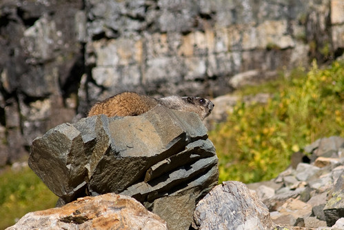
As we walked through and past slides of jumbled rock I’d hear, and occasionally catch a glimpse of, a pika. Unfortunately, none of them wanted to be photo models. This ground squirrel was far more cooperative.
At long last (remember, each step I took was painful) we had put Haystack Butte behind us and had passed the half-way point on this hike.
And what’s that I see? A break in the clouds?! Yes!!!
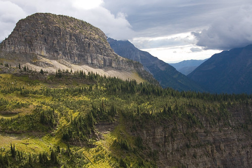
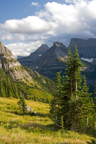
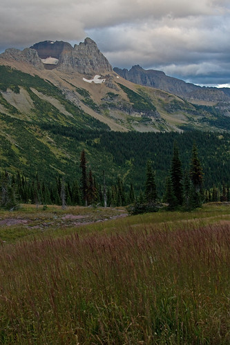
For a time the storm clouds above us made way for blue skies and cotton candy clouds. 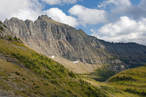
Having grown accustomed to the dim light under the storm clouds, the sudden sunshine seemed quite bright and seemed to almost glare off the white coats of the mountain goats that we came upon during this brief period of sunshine. 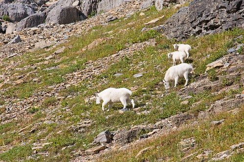
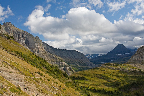
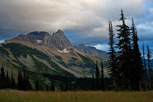
The view looking back at Mount Reynolds, Mount Oberlin and Mount Cannon continued to be a treat.
The pikas continued to play their ventriloquist game and continue to elude my lens. However, I did spy a hoary marmot taking advantage of the break in the storms to sun himself on a rocky sofa. A faster hiker than myself (like Matt, for instance) might have missed him entirely as he was fairly well camouflaged.
Matt was on the lookout for bigger critters, too, as we’d been told that there was a griz in the vicinity. We never did see it, though…
The sunshine that we (and the marmot) enjoyed was short lived. While we remained, for the time, under the sun, to the north of us storm clouds glowered over the peaks.
While to the south of us storm clouds rolled in, though Lake McDonald appeared to be still seeing the sun.
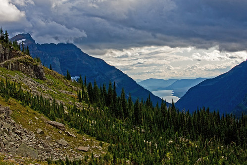
By this time, looking back, besides affording a great vista, was quite satisfying. The mountains that once seemed so near now seemed quite distant.
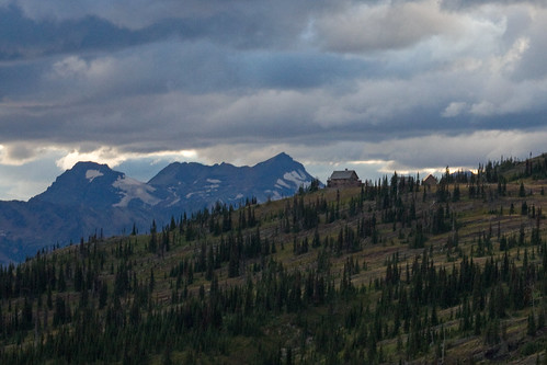
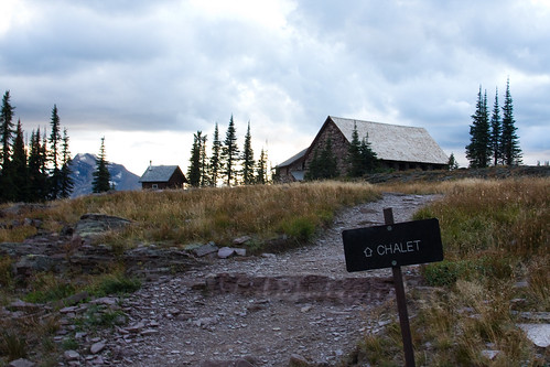
And, looking ahead, we could see the Granite Park Chalet, though it was still about a mile and a half away.
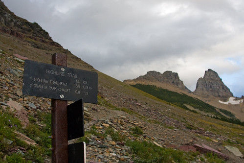
The trail post at the junction with the Grinnell Glacier Overlook Trail marked the last leg — just .8 miles to go.
Still more beauty to behold on the way.
As the evening light waned, we reached the chalet.
I released my feet from the boots that had become torture chambers and emerged from our cabin room just in time to see the last light of the setting sun kiss the peaks of the mountains.

Then into the chalet we went to grab a bite to eat, meet our fellow overnighters, and listen to one of our hosts, Clayton, give a brief history of the chalet.
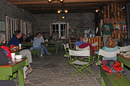
While once Granite Park Chalet was a full service destination, it is now a no frills hikers’ hostel. No frills means no electricity, no indoor plumbing (there are sinks but they are no longer plumbed), an outbuilding vault for potty, no insulation, propane lights in the main chalet building but no lights in the sleeping areas. Perfect!
Okay, maybe not quite perfect. The cold resulting from the lack of insulation (as Clayton put it, the indoor temperature is a match to the outdoor temperature — just out of the wind) didn’t bother us overmuch, as we had adequate warm clothing. However, the lack of insulation also meant that we could hear mere whispers from other guests in the same building at night. Ear plugs were available for those who wanted them. However, given the ideal location, the noise at night is no more than a minor inconvenience.
Hike details:
- distance: 7.6 miles
- elevation gain: 830 ft. (plus some ups and downs where elevation lost must be regained)
- beginning elevation: 6,540
- ending elevation: 7,280 ft.
In my next blog installment I’ll report on our day at the chalet and on our hike out via The Loop Trail.
Recent Comments